The devastating nature of a flood is painfully apparent, but it is still shocking to discover the final tally for total damage to businesses, communities and lives. Spurred by climate change, deforestation, urban development and population movements, the risk of major floods is increasing. With so much destructive power, preparing for the worst and mitigating the damage floods can create has never been more critical.
While policymakers continue to argue the best policies to combat climate change, the market is acting. Over the last decade, new monitoring, weather and hydrological modeling, risk reduction and other technologies have become available and are helping businesses and municipalities better prepare, forecast and detect flood events, increase lead time for emergency officials and first responders, and even decrease the impact of floods on their communities.
Effective flood and severe weather management solutions curate and combine data from a multitude of sensor networks with predictive models and artificial intelligence into actionable insights to better inform risk decisions and build resiliencies for all stakeholders, including state and local government agencies, public works and infrastructure, first responders, and impacted communities and businesses.
Protecting Public Infrastructure
At-risk communities—any development in a flood plain that fast-rising floodwaters would directly impact—are the most vulnerable. As more extreme rainfall events continue to occur, emergency leaders need tools to prepare, detect and forecast flooding events to protect these communities. Dams and reservoirs are meant to help control flooding, but they also bring their own risk. Extreme events, poor design and maintenance, or defects can make dams susceptible to failure. Modern sensor instruments and integrated networks help anticipate inflow ahead of the rainfall observations. Dam safety software immediately updates seismic activity and alerts personnel to conduct inspections for potential infrastructure stress.
Levees, too, are incredibly vulnerable during extreme storm events. Major rainfall events can put levees at risk of overtopping, and as seen during Hurricane Katrina, the consequences can be monumental. Remote erosion systems automatically warn and alert of erosions at critical levee segments with embedded sensors before the water recedes. The early warning of damage to these structures allows municipalities the lead time they need to make effective structural changes before a major flood event happens, rather than in the wake of a disaster. This lead time effectively saves lives and the integrity of nearby businesses and public infrastructure.
Protecting Airports
Severe weather is also one of the biggest threats to airport operations, yet it is highly predictable. Innovative weather sensors and data systems protect ground crews, passengers and airport personnel while safeguarding capital assets through better preparation plans and checklists based on advanced weather data. Integrating current and holistic data along with monitoring technology can:
- Reduce crew and passenger injuries from lightning or flooding
- Ensure operational continuity with automated alerting and countdown clocks
- Minimize false alarms that slow operations and cause unnecessary disruption
- Improve on-time performance with real-time weather data
Spurred by insurance losses and major operational disruptions after severe flooding events in San Francisco, Brisbane and Sydney, Australia and Singapore, airports are beginning to initiate better adaptation and mitigation measures to meet the challenge posed by extreme weather. While infrastructural efforts, such as building higher seawalls and new flood barriers, are important, better sensor and monitoring networks to improve forecasting and prediction are crucial, more cost-effective measures that can help improve safety and mitigate risk.
Protecting Schools
School districts must do everything they can to keep students, faculty and visitors safe from thunderstorms, tornadoes and other dangerous weather conditions. An integrated suite of flood and severe weather intelligence solutions allows schools to increase safety and preparedness. Automated severe weather detection and alerting tracks dangerous weather in real-time and provides holistic data to better informs and speed decision-making. It can alert when lightning approaches a pre-defined radius around facilities or monitor and alert rising flood risks. Historical and real-time data can help school officials make better weather-related safety decisions with their own localized data.
Impact of Urban Structural Development and Design
Urban flooding is becoming a significant danger due to new development's impact on legacy development. For instance, Ellicott City, Maryland suffered two “1,000-year” storms in less than two years, and historic flooding events in urban areas are becoming “flashier” and more commonplace. Decades of suburban development patterns have replaced soil and trees with roads, buildings and other impervious infrastructure. Accurate estimation of rainfalls’ spatial distribution is vital to successfully model hydraulic processes as flood damage can devastate community property and vital infrastructure—especially without preparation.
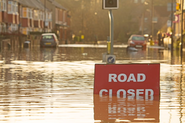
With data capture and extensive sensor networks, community leaders have the tools to assess all possible storm events and conditions to help build the most advantageous designs for stormwater runoff, flow and drainage. This lessens the impact of flooding and provides community leaders with information that can guide flood control operations and emergency actions such as evacuations and road closures.
Forewarned Is Forearmed
An effective flood risk management system must do more than just collect information. It must provide actionable data that helps emergency managers and business leaders make better decisions quickly. A comprehensive flood management solution addresses six critical missions to keep people and communities safe and functioning, including:
- Planning: Flood Early Warning Systems (FEWS) network design and maintenance, flood modeling services and Emergency Action Plan (EAP) Development
- Prediction: Real-time flood forecasts and modeling, 24/7 expert meteorologist support
- Detection: FEWS, Remote Erosion Monitoring Systems (REMS), radar rainfall estimates
- Response Management: public awareness and warning systems, driver warning systems and EAP alarming
- Mitigation: Historical radar rainfall, rain gauge and stream data, storm analysis
- Risk Assessment: Monitoring systems and historical and real-time data give managers a clearer picture to better assess risk.
Implementing end-to-end solutions—planning, detection, prediction, response management and mitigation—can substantially improve emergency leaders’ flood management efforts and community resiliency, ultimately protecting public infrastructure. Reducing flood risk requires a holistic approach where networks, sensors, modeling and AI work seamlessly to help emergency leaders increase the lead time before a flood, provide more time to make informed decisions, prepare accordingly, limit the damage and save lives.