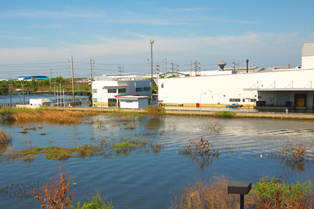
Flooding caused widespread destruction in the United States in 2023. Four separate billion-dollar flood disasters in California, Florida, Vermont and along the East Coast caused nearly $10 billion in damages to homes, businesses and infrastructure, according to NOAA's National Centers for Environmental Information. In fact, floods have caused more than $850 billion in damages in the United States since 2000 and are responsible for two-thirds of the cost of all natural disasters. As climate change makes it more difficult to accurately predict where flooding will occur and the potential extent of damage, risk professionals need to take steps to ensure that their organizations are protected.
Underestimating Flood Risk
To manage flood risks, organizations typically first look to the insurance market. Commercial property insurance policies and business owners’ policies often exclude damages to buildings and contents caused by flooding. The federal government’s National Flood Insurance Program (NFIP) provides insurance to help absorb the damage, offering up to $500,000 in flood insurance coverage for a commercial building and up to $500,000 for the building’s contents. For exposure beyond these limits, risk managers can purchase excess flood insurance from commercial insurers.
NFIP does not cover damages to business vehicles and flood-related financial losses caused by a business interruption, but coverage for those losses is available in the insurance market as well. The problem is that many companies are unaware of and unprepared for the risks their businesses face from flooding. According to a Chubb survey, 85% percent of companies mistakenly believe their property insurance covers some, all or most types of flooding. The survey found a severe underestimation of the gravity of commercial flood risk, which is “far more pervasive with the increasing frequency and severity of extreme weather events,” according to Louis Hobson, senior vice president of flood insurance in North America at Chubb.
Underwriting for various NFIP insurance policies and coverages is based in large part on the Federal Emergency Management Agency’s (FEMA) 100-year floodplain maps. These maps estimate the potential for a flooding event to damage commercial buildings and residential homes in a given area. Geographic areas with a 1 in 4 chance of flooding over a 30-year period are defined as a Special Flood Hazard Area, the highest risk rating.
Unfortunately, climate change has rendered many of these maps increasingly inaccurate, resulting in significant flood risk blind spots. “FEMA maps only reflect past events, which is not enough to predict future potential damage,” said Martha Bane, property practice leader at Gallagher.
According to climate risk and quantification research group First Street Foundation, the maps underestimate the number of homes and businesses at risk of flooding across the lower 48 states by 67%. Although the National Flood Insurance Reform Act of 1994 requires FEMA to revise and update the flood maps every five years, First Street Foundation found that three-quarters of the maps are more than five years old, with 11% dating all the way back to the 1970s and 1980s. “There is also a large inventory of unmapped places in the country,” Hobson said. “Rough estimates indicate that 6,500 communities of the 22,000 counties that FEMA assesses are unmapped. Roughly 2.3 million miles of the 3.5 million-mile river network in the country are unmapped, along with 55,000 miles of the 95,000-mile coastlines.”
Last year, FEMA updated its 50-year-old measurement system with a new pricing methodology called Risk Rating 2.0. This methodology considers a broader range of flood frequency data in underwriting the risk, including storm surges, tsunamis and coastal erosion, as well as so-called “pluvial risks”—intense bursts of rainfall that are a major cause of flooding in cities and other urban environments. The new methodology also considers a building’s replacement cost, which is determined using information provided in the flood insurance application.
While these new considerations may be a step forward, John Dickson, president of Aon Edge, an agency within insurance broker Aon that offers excess flood insurance through the NFIP, pointed out that there are inherent limitations in a model based in part on predicting unexpectedly severe rainfall patterns. Last year, for example, flooding caused by “atmospheric rivers”—long, concentrated regions in the atmosphere that transport moist air from the tropics to higher latitudes—drenched Southern California, the California Central Coast, Northern California and Nevada, causing more than $4.6 billion in property damage. Earlier this month, atmospheric rivers struck California again, dropping more than eight inches of rain on Los Angeles over a three-day period and causing nine deaths and hundreds of millions of dollars in damages throughout the state. “Such massive scale flooding events caused by incredible rainfall are happening more and more,” Dickson said. “FEMA is responsible for maintaining flood maps, but water does not know how to stop at imaginary [geographic] lines.”
Proactive Flood Risk Management
Regardless of the accuracy of FEMA’s flood maps, organizations need to take steps to help safeguard commercial properties from flood damage and ensure their flood insurance premiums reflect actual exposures. For example, just because a property is in a FEMA-designated flood zone does not mean it is automatically at high risk for flood damage. “We have gone beyond what the maps tell us in adding additional height to new infrastructure,” said Denise Cosentino, director of enterprise risk management at Eversource Energy, citing a substation the Eversource Energy built in South Boston’s seaport district in 2017. “We dug 80 feet into the existing bedrock to keep the substation 15 feet above ground level, which can better withstand severe storms and tidal surges. Most insurance policies sublimit property located in high-hazard flood zones. We asked our property insurers’ loss control people to visit these properties and see what we have done to provide full flood limits and they have been receptive.”
Risk professionals may also be able to secure better rates and coverage by highlighting specific flood exposure conditions and mitigation measures in the property insurance application. For example, they can detail favorable topography and elevation, or highlight that the company has a robust and regularly tested business continuity plan. “The more specific risk managers can be about the elevation of the first floor, their flood protection investments to alleviate potential losses, and their planned incident response and disaster recovery actions, the less uncertainty carriers will have in making their underwriting decisions,” Bane said.
According to Ted Cabaniss, lead risk control consultant at QBE North America, risk professionals should consider the following questions when completing the insurance application: “Are you in a known flood zone or close to one? Does the building have low-lying features like shipping and receiving docks where water can enter the structure? Do you regularly inspect the drains to be sure they are not blocked? Do you have flood gates and know where they are stored? Do you practice installing the gates once a year? And do you have a written flood disaster and business continuity plan that lays out everyone’s responsibilities?”
While it may seem obvious, risk professionals should also pay close attention to providing accurate building location information. “We have seen situations where a large client with hundreds of buildings sends over the replacement cost values for the buildings they own and many of the buildings are nowhere near the locations in the spreadsheet,” said Kristin Carrington, founder and CEO of risk engineering consulting firm SnapRISK. “One client with 10,000 locations provided locations that indicated 12 buildings were physically in the Atlantic Ocean. We have had other clients that still listed buildings [in the insurance application] that were sold years ago. Why pay the highest NFIP rates when you do not have any buildings that are affected?”
Monte Carlo simulations and catastrophic flood modeling can also have a significant impact. “The models take commercial client data like where buildings are located, whether they are built of brick or wood, when they were built, and so on and then run thousands of simulations to assimilate every realistic type of flooding disaster into the loss estimates,” Bane said. “Cat models have been a game changer. We use them in addition to FEMA maps, knowing their limitations. Buildings do not need to be in a flood zone to suffer a flood loss.”
Many companies are also looking to technology to offer more precise data. For example, some companies are using laser-scanning tools like LIDAR to identify low-lying areas of property that may be vulnerable to flooding. “For some clients, our technology people will send up drones with LIDAR to scan around facilities to provide more accurate risk data,” she said.
In crafting Eversource Energy’s flood insurance application, Cosentino reported doing much of the above and more. “In 2022, our engineering department hired a consultant to overlay a report by the Intergovernmental Panel on Climate Change that predicts the impact of climate change on the infrastructure in our service territory over the next 50 years,” she said. “I have since put the report in my presentation to the flood insurance markets.”